One day, three peaks
Mount Arab, Goodman Mountain, and Coney Mountain are on the lineup for a new ultra-challenge called the Tupper Lake Triad.
Individually, none of these peaks are all that difficult of an endeavor but put them into one day and the challenge is on. By themselves, the hikes don’t exceed much more than a mile-and-a-half to the summit, but the complete loss of elevation and drive between the three makes them much more than a ridge walk.
There are other ultra-challenges around the Adirondacks. Become a Saranac Lake Ultra 6er by climbing all six peaks in a 24-hour period. That might be out of reach for most average hikers; however, this three-peak ultra might be just right for you. It sure was for me.
I had no real interest in doing the Ultra 6er, which entails more than 30 miles of hiking, 8,000 feet of elevation gain, and roughly 16 hours of hiking and driving. So I set my sights on a challenge that is much easier to swallow — the Tupper Lake Triad. It's 7-plus miles of hiking, and about 2,000 feet of elevation gain, which is much more appealing in that it can be done in a much shorter day. I ended up completing it in a bit under eight hours, and I assure you I didn’t break any land speed records.

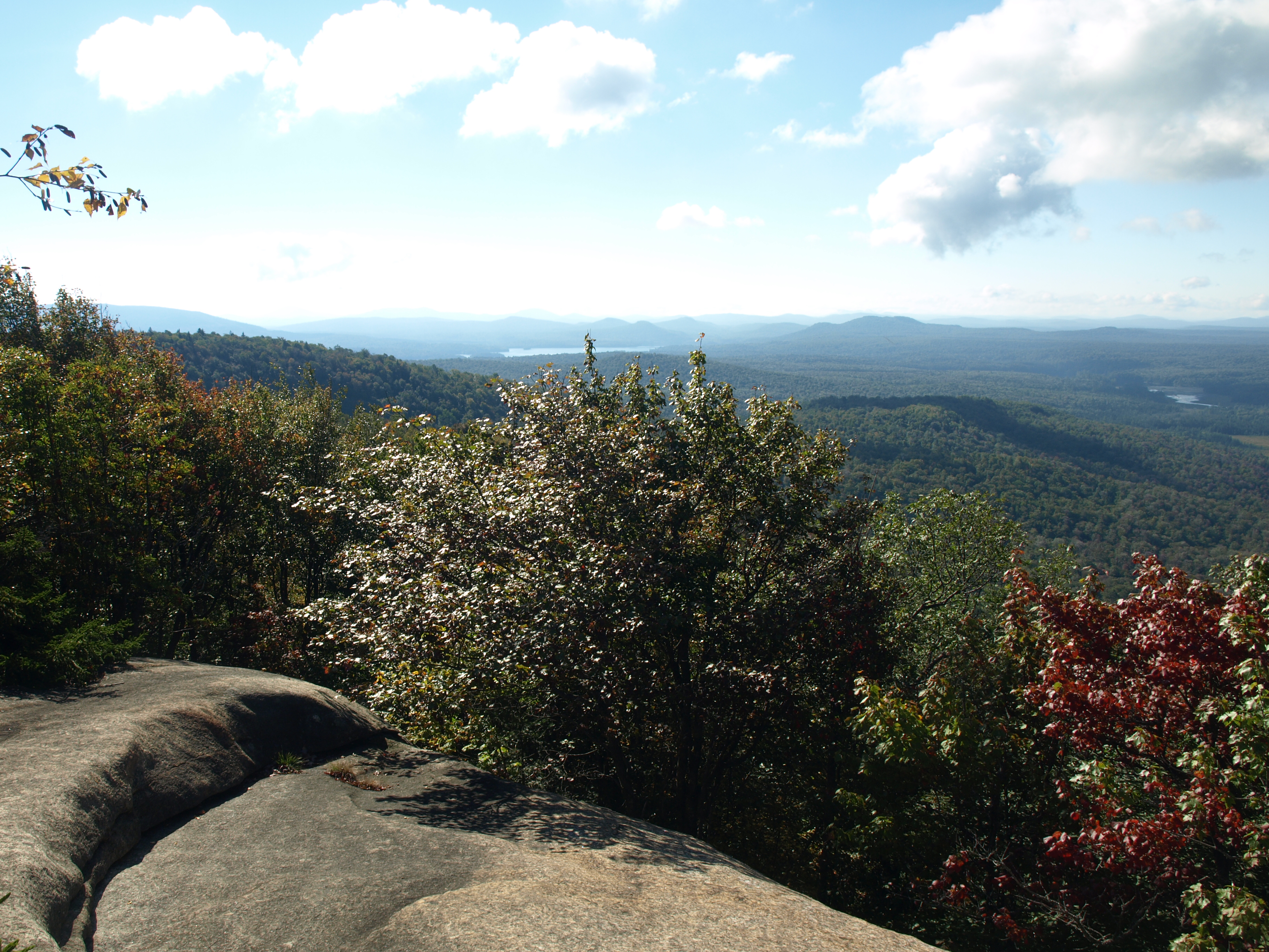
I started with Arab, the peak that was closest to home for me. Also, I had it in the back of my mind that if I did this first my muscles would tighten up too much during the commute to the other two, which are neighbors. I also left my camera at home. Since I don’t own a point-and-shoot version, the bulky DSLR would just get in the way as it bounced around on my hip or in the pack, so I apologize that the pictures here are not from the day’s adventure but are instead a look at what the mountains have to offer.
The trail was completely snow covered, but the soil beneath was still soft under foot. It snowed a dusting the night before but the warm weather prediction for the afternoon was sure to melt that away. I quickly found myself at the base of the long staircase, which I quickly learned was covered in a thin layer of slush and ice. Above the staircase a bit more ice started to appear and the ground beneath was much harder, reducing ample traction and causing me to spin my wheels on occasion; what an odd spring.

After a long, mellow walk atop the ridge I stood below the tower. I ran up the tower really fast, mainly because I wasn’t all that sure if that was a requirement of the challenge or not. I figured it wasn't, but I played it safe. After a quick drink I turned face and started my descent. My pack was much heavier than most would carry for speed climbs, but I am still a weary traveler with equipment for the “what if” situations. The descent was actually quite fun, and with the slippery conditions and use of my trekking poles I made it down in fine fashion. Now it was off to Coney, the farthest away.

I have a deep memory of climbing Coney for the first time by using the herd path, which was a steep and muddy mess. That was back in the mid-'90s, if I recall. Today I had the luxury of a marked foot trail. It’s still a fairly new addition to the region, but because of its newness and ease of access it gets heavy traffic.
The parking area was full, even at midmorning so I found myself parking on the roadside of Route 30. I was enveloped in the challenge by this point and started a rather quick pace as I quickly came to and passed below many of the cliffs, and to my pleasure the area didn’t get any snow overnight, so the rocky trail didn’t have any additional reason to be slippery. I quickly made my way around the back of the mountain and continued up and over the open terrain, which did have a slight dusting that covered the slab rock.
I tapped the top, explained my rush to an older couple, and started a descent that wasn’t as fluid as I would have liked. The rocks on the trail and periodic roots slowed the descent considerably — the fear of a dreadful, high speed crash on a steeper slope required me to slow down a bit. A couple close calls paid that bill.
Once out of the woods I was happy to not have to drive all that far to Goodman Mountain. It's literally just a mile or so down the road, just enough time to rehydrate and eat a “meal in a bar.” No, not a pub — that might be later — but a bar of grains and fruits and whatever else they whipped together. This one had chocolate, which in my opinion should be in every bar.

This little gem is located behind Lumberjack Spring. The bridge over a swollen Cold Brook was my flag to start the ascent. The beginning was so easy and a perfect end to the day, as I made great time and continued up the old main road that used to connect Long Lake to Tupper Lake. I then arrived at the height of land along the road and looked forward to finally hitting my final portion of trail.
The fallen leaves, covered in a fading dusting of snow, would surely be a slippery descent, but on the way up they actually gave decent traction to push off from. After a short, steep section I was atop the ridge, and soon I was on the rocky summit overlooking the Horseshoe Lake Wild Forest. I didn’t hang out very long, and an interesting cloud formation actually made me wish I had a small camera to capture the day. My stomach was talking to me, and all I wanted was to get back down to grab some “real food” and take a long, hot shower before crashing in front of a movie.
Click the link for more information about the Tupper Lake Triad. There are lots of other hikes in the Tupper Lake Region, and there are dozens of lakes and waterways to explore by boat as well.