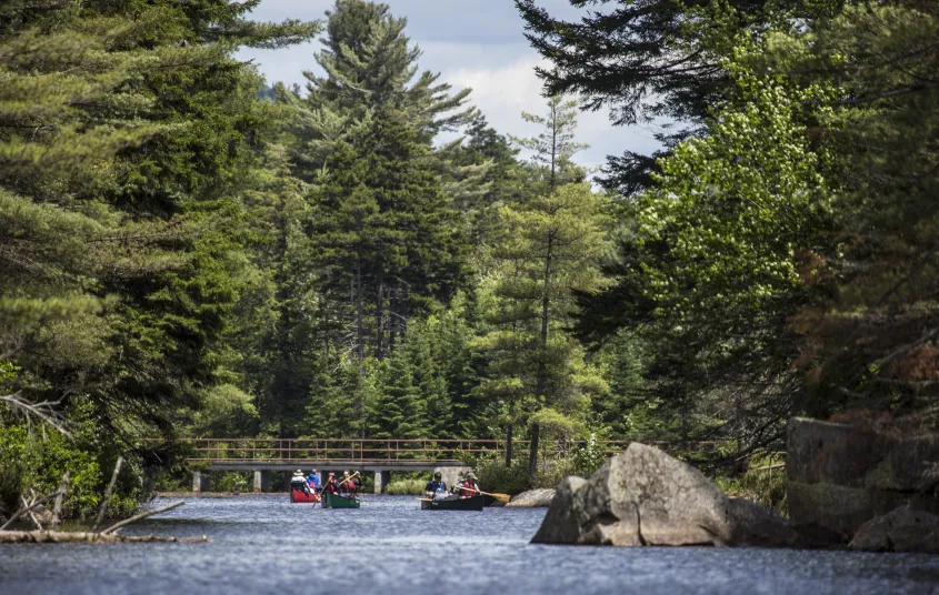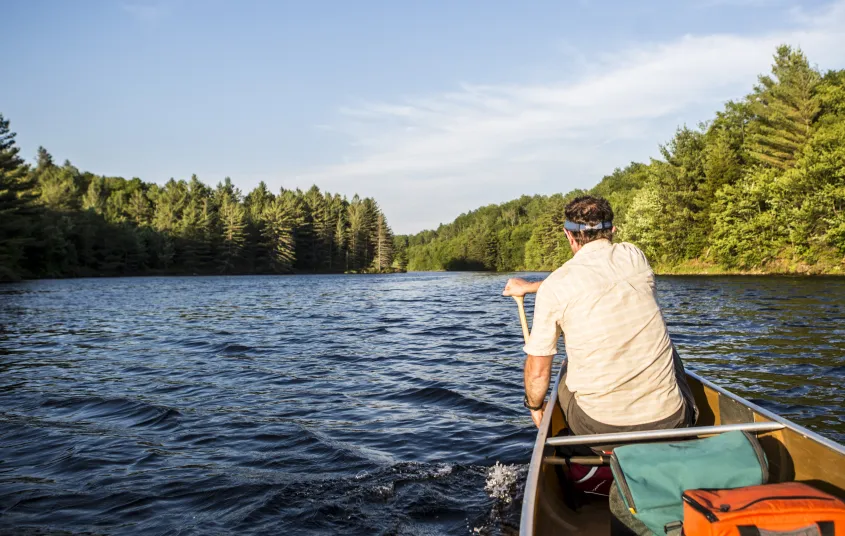


The gently-hilled road to Lows Upper Dam and Hitchins Pond is a nice summer hike and winter cross-country ski in the Five Ponds Wilderness. Options to reach this spot also include via paddle from Lows Lower Dam. Both of these options are how you access Lows Ridge (Lows Overlook).
Key takeaways
- Distance: 4.75 miles round trip
- Elevation gain: 150 feet
- Hike includes a road walk and trail junctions
- Based on a hike from the summer trailhead to the dam
Hiking to Hitchins Pond
This is a popular multi-use destination in the summer, with access to other trails with scenic overlooks, and a spur trail for easy shoreside access.
From the gate, the hike is straightforward and along an old woods road. You'll pass by Hitchins Pond Bog, a massive peatland that is one of the largest in the state. At the dam, you can take an optional 1.7 mile round trip hike up Lows Ridge (aka Lows Overlook) where there are spectacular views of the Bog River Valley and High Peaks.
Hitchins Pond in the winter
In the winter it gets much less use due to closed access roads. You will need to start further away at the snowmobile trailhead. The road is very flat and used as a snowmobile trail so it will be hard packed and easy to kick and glide upon. Along the 2.3 miles on Horseshoe Lake Road there are nice views over Horseshoe Lake and some wetland areas. If you carry in snowshoes with you, Lows Overlook is an excellent winter hike. Even with regular snowmobile usage, this is still deep in the woods. In the winter, be prepared for all conditions, and take care around frozen bodies of water. Do not attempt this trip if you a beginner cross-country skier or winter hiker.
Discover more trails near Tupper Lake
Do Lows Upper Dam and Hitchins Pond sound amazing, but a little more than you want to tackle right now? No need to stress, with endless mountains, lakes, and waterfalls to visit in the Adirondacks, we are sure we can help you discover a trail that’s just right!
Paddling
While you can carry a lightweight boat on this route, most people use Lows Lower Dam to access Hitchins Pond. There are 5 designated camping sites on the shore of Hitchins Pond. This is also a good way to get to the Lows Overlook hike. Hitchins Pond has plentiful loons, along with osprey, ravens, spruce grouse, and bald eagles for people who want to bird.
How to get there
From Tupper Lake, head southwest on Park St toward High St for 0.2 miles. Turn left onto NY-30 S/Wawbeek Ave, and continue for 8.7 miles. Take a left on CR 421 heading west. Follow the road (CR 421) for 6.5 miles. Cross the railroad tracks and continue for 1 mile to a fork in the road, with a yellow gate across the left road. Park at this point. The road to Hitchins Pond/Upper Dam is the one on the left, past the gate.


Packages and Promotions
Valid
Valid Jun. 15 - Oct. 15
weekly on Wednesday until October 16, 2025
Wing Wednesdays: Full Flavor, Half Price!
The Clubhouse at TLGC
Dig in and save big! Join us every Wednesday at The Clubhouse at Tupper Lake Golf Club for Wing Night Wednesdays, featuring 50% off chicken wings from 4:00 to 8:30 PM.
Valid Jun. 30 - Jun. 30
Valid Jun. 30 - Dec. 31
Tri-State Resident discount at Trailhead
Trailhead by Weekender
We're thrilled to announce our State Resident Rates, an exclusive offer for our most loyal local guests!
<Valid Mar. 31 - Jan. 29
Valid Jan. 20 - Jan. 20
Pet Getaway
Voco Saranac Lake
Your dog deserves an Adirondack getaway too. Book our pet friendly hotel near Lake Placid welcomes every member of your crew. Book our Pet Package and enjoy a dog friendly room with pet fees included.
Valid
Valid Mar. 31 - Mar. 31
The Wild Center Family Getaway
Voco Saranac Lake
Enjoy 2 adult and 1 child admission tickets to The Wild Center, where nature meets discovery.
Valid Mar. 31 - Oct. 30
Valid Apr. 14 - Oct. 30
Golf & Stay
Voco Saranac Lake
Tee off at one of the Adirondacks' historic golf courses, surrounded by breathtaking mountain views.
Valid
Valid Jun. 13 - Oct. 15
weekly on Monday until October 14, 2025
Mexican Mondays
The Clubhouse at TLGC
Head to The Clubhouse for bold flavors, rotating Mexican dishes, and $6 margaritas every Monday.
Valid Jan. 20 - Jan. 20
Valid Jan. 20 - Jan. 20
Stay and Dine
Voco Saranac Lake
Receive a 50 dollar credit per stay to use in our Lakeside Drift. Enjoy an exceptional dining experience with unparalleled views great food and craft beers in a friendly and relaxed environment.
Valid
Valid Jun. 15 - Aug. 30
weekly on Friday until August 31, 2025
2 for 1 Happy Hour Cosmos and Friday Fish Fry
P-2's Irish Pub
Start your weekend right with 2-for-1 Cosmopolitans for just $8 every Friday at P-2’s Irish Pub—plus don’t miss our Friday Fish Fry!
Valid
Valid Jun. 15 - Oct. 15
weekly on Friday until October 17, 2025
$20 Fish Fry Friday
The Clubhouse at TLGC
Get Hooked on Fish Fry Friday at The Clubhouse
Join us every Friday at The Clubhouse at TLGC for a delicious Fish Fry Friday tradition.
Valid
Valid Jul. 22 - Aug. 30
weekly on Monday, Tuesday, Wednesday, Thursday and Friday until August 30, 2025
Caribbean Kitchen Takeout
Faust Motel
Caribbean Kitchen Pop-Up Takeout Returns
Valid Jul. 31 - Aug. 2
Valid Mar. 31 - May. 30
BikeADK Loves Canada - Weekender
Canadian Residents can use the code “BikeADKLovesCanada" will receive 15% off their registration!
Valid
Valid Jun. 15 - Oct. 16
weekly on Tuesday until October 21, 2025
Taco Tuesday at RRB
The Marketplace - Food Truck
Free RRB Margarita with Your Marketplace Food Truck Tacos
Join The Marketplace Food Truck and Raquette River Brewing for the ultimate Taco
Valid Jun. 30 - Jun. 30
Valid Jun. 30 - Jun. 30
Stay More, Save More with Trailhead
Trailhead by Weekender
Valid Mar. 31 - Oct. 30
Valid Apr. 14 - Oct. 30
Paddle & Stay
Voco Saranac Lake
Escape to the serene beauty of the Adirondacks and immerse yourself in nature as you paddle the tranquil waters of Lake Flower in a kayak, canoe, or SUP
Valid Jul. 13 - Jul. 13
Valid Jul. 13 - Jul. 13
3rd Night Free at Trailhead
Trailhead by Weekender
Book two consecutive nights at our regular Best Available Rate and get your 3rd night on us. Staying longer than three nights? 3rd Night Free! is available for EVERY 3rd night.
Valid Jun. 30 - Jun. 30
Valid Jul. 13 - Jun. 30
Book Now, Adventure Later with Trailhead
Trailhead by Weekender
Book two or more consecutive nights 45+ days in advance and receive up to 20% off, with the flexibility to adju
Valid Mar. 31 - Oct. 30
Valid Apr. 14 - Oct. 30
Bike & Stay
Voco Saranac Lake
Explore the beauty of Saranac Lake and the newly developed Adirondack Rail Trail.
Valid Jul. 3 - Aug. 30
Valid Jul. 1 - Jul. 30
Classic Films, Summer Vibes – Only $5
Adirondack State Theater
$5 classics. Cool theater. Daily at 4 PM. All summer long, the Adirondack State Theater brings timeless films to the big screen for just five bucks.
Valid Mar. 31 - Oct. 30
Valid Apr. 14 - Oct. 30
Fish & Stay
Voco Saranac Lake
Enjoy a 2-hour fishing session on Lake Flower for two, guided by expert anglers.
Valid Jun. 30 - Sep. 29
Valid Jun. 30 - Sep. 29
weekly on Monday, Tuesday, Wednesday, Thursday, Friday, Saturday and Sunday until September 30, 2025
Timberjaxx Pass Loyalty Card
Timberjaxx Pass
Get the Timberjaxx Loyalty Card and earn a free game after five rounds. Fun, treats, and no card to carry.