
This trail, at this time is not marked, and can be found under various conditions of use.
Key takeaways
- Distance: 3.25 miles round trip
- Elevation gain: 360 feet
- Hike includes trail junctions, unmarked trail, a road walk, and a bridge
- Based on an out-and-back hike to the river
Hiking the Bog River Trail
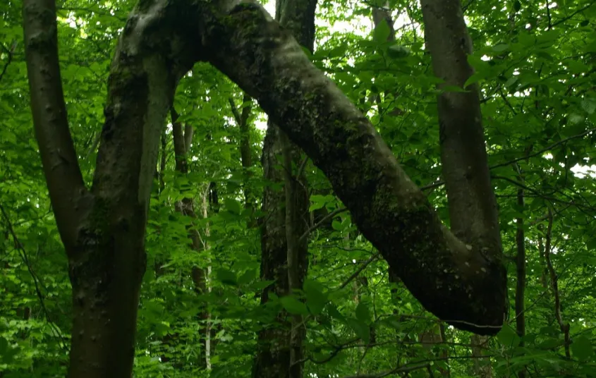
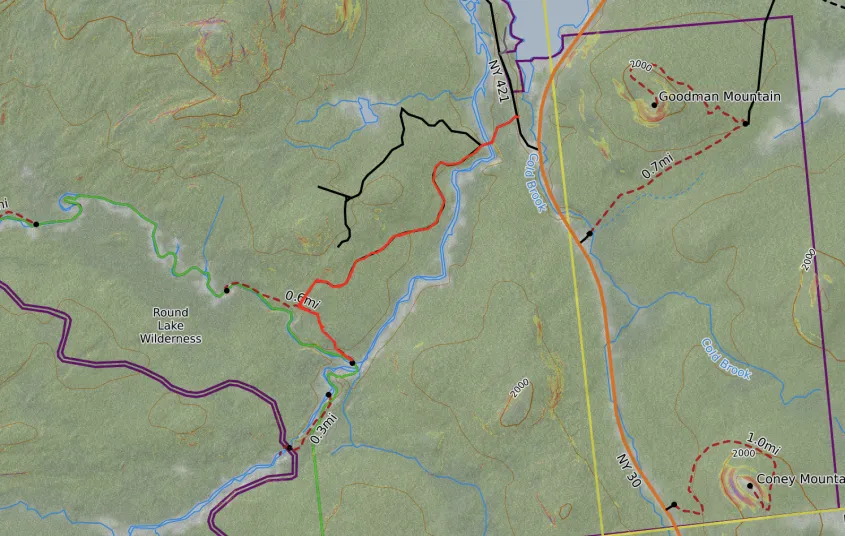
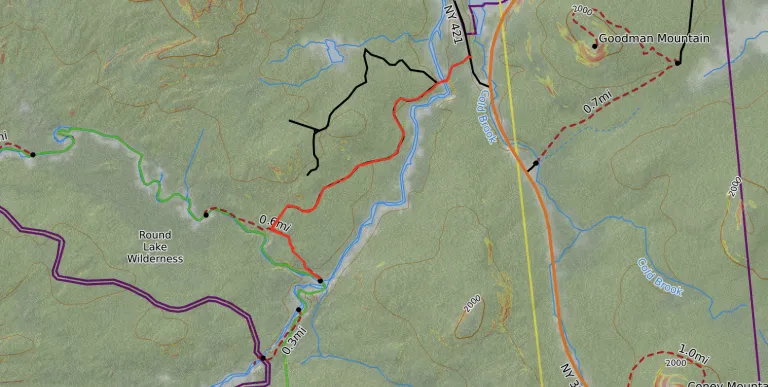
From the gate, pass through and hike along an old road to an old bridge over the Bog River. Cross the bridge and quickly come to a second intersection. This intersection is not as obvious, head more left. This trail is quite obvious but doesn’t get a ton of use from hikers, it is more of a ski trail, and not marked. The trail is rather flat for most of its course. There is one decent hill you will ascend and a long descent will bring you down to the shore of the Bog River. At 1.3 miles in, you'll come to an intersection. Keep right, and descend to the river. Herd paths follow the shore in both directions. Be aware that this trail is very wet in sections along the old carriage road, especially under spring conditions.
Bog River Trail follows several old haul roads through the WF between State Route 421 and the Bog River. Depending on the combination of routes used, loops ranging from 5 to 8 miles are available.
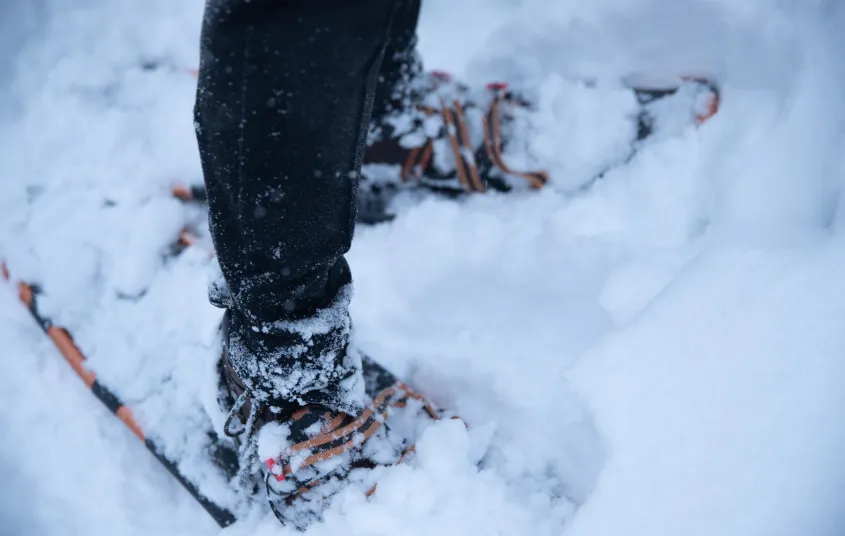
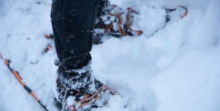
Big River Trail in the winter
This trail does get local use from cross-country skiers, albeit infrequently. You should only attempt to get on this trail if you have experience in map and compass fundamentals, are an experienced winter skier/hiker, and are prepared for all winter conditions. Be extra careful around frozen bodies of water.
Discover more trails in Tupper Lake
Does the Bog River Trail sound amazing, but a little more than you want to tackle right now? No need to stress, with endless mountains, lakes, and waterfalls to visit in the Adirondacks, we are sure we can help you discover a trail that’s just right!
How to get there
From the intersection of Route 3 and Route 30 in the Village of Tupper Lake follow Route 30 toward Long Lake. Continue to Route 421 (Horseshoe Lake Road) on your left. Follow Route 421 for about 0.1 miles to a yellow state gate on the left, park here.
Packages and Promotions
Valid
Valid Jun. 15 - Oct. 15
weekly on Wednesday until October 16, 2025
Wing Wednesdays: Full Flavor, Half Price!
The Clubhouse at TLGC
Dig in and save big! Join us every Wednesday at The Clubhouse at Tupper Lake Golf Club for Wing Night Wednesdays, featuring 50% off chicken wings from 4:00 to 8:30 PM.
Valid Jun. 30 - Jun. 30
Valid Jun. 30 - Dec. 31
Tri-State Resident discount at Trailhead
Trailhead by Weekender
We're thrilled to announce our State Resident Rates, an exclusive offer for our most loyal local guests!
<Valid Mar. 31 - Jan. 29
Valid Jan. 20 - Jan. 20
Pet Getaway
Voco Saranac Lake
Your dog deserves an Adirondack getaway too. Book our pet friendly hotel near Lake Placid welcomes every member of your crew. Book our Pet Package and enjoy a dog friendly room with pet fees included.
Valid
Valid Mar. 31 - Mar. 31
The Wild Center Family Getaway
Voco Saranac Lake
Enjoy 2 adult and 1 child admission tickets to The Wild Center, where nature meets discovery.
Valid Mar. 31 - Oct. 30
Valid Apr. 14 - Oct. 30
Golf & Stay
Voco Saranac Lake
Tee off at one of the Adirondacks' historic golf courses, surrounded by breathtaking mountain views.
Valid
Valid Jun. 13 - Oct. 15
weekly on Monday until October 14, 2025
Mexican Mondays
The Clubhouse at TLGC
Head to The Clubhouse for bold flavors, rotating Mexican dishes, and $6 margaritas every Monday.
Valid Jan. 20 - Jan. 20
Valid Jan. 20 - Jan. 20
Stay and Dine
Voco Saranac Lake
Receive a 50 dollar credit per stay to use in our Lakeside Drift. Enjoy an exceptional dining experience with unparalleled views great food and craft beers in a friendly and relaxed environment.
Valid
Valid Jun. 15 - Aug. 30
weekly on Friday until August 31, 2025
2 for 1 Happy Hour Cosmos and Friday Fish Fry
P-2's Irish Pub
Start your weekend right with 2-for-1 Cosmopolitans for just $8 every Friday at P-2’s Irish Pub—plus don’t miss our Friday Fish Fry!
Valid
Valid Jun. 15 - Oct. 15
weekly on Friday until October 17, 2025
$20 Fish Fry Friday
The Clubhouse at TLGC
Get Hooked on Fish Fry Friday at The Clubhouse
Join us every Friday at The Clubhouse at TLGC for a delicious Fish Fry Friday tradition.
Valid
Valid Jul. 22 - Aug. 30
weekly on Monday, Tuesday, Wednesday, Thursday and Friday until August 30, 2025
Caribbean Kitchen Takeout
Faust Motel
Caribbean Kitchen Pop-Up Takeout Returns
Valid Jul. 31 - Aug. 2
Valid Mar. 31 - May. 30
BikeADK Loves Canada - Weekender
Canadian Residents can use the code “BikeADKLovesCanada" will receive 15% off their registration!
Valid
Valid Jun. 15 - Oct. 16
weekly on Tuesday until October 21, 2025
Taco Tuesday at RRB
The Marketplace - Food Truck
Free RRB Margarita with Your Marketplace Food Truck Tacos
Join The Marketplace Food Truck and Raquette River Brewing for the ultimate Taco
Valid Jun. 30 - Jun. 30
Valid Jun. 30 - Jun. 30
Stay More, Save More with Trailhead
Trailhead by Weekender
Valid Mar. 31 - Oct. 30
Valid Apr. 14 - Oct. 30
Paddle & Stay
Voco Saranac Lake
Escape to the serene beauty of the Adirondacks and immerse yourself in nature as you paddle the tranquil waters of Lake Flower in a kayak, canoe, or SUP
Valid Jul. 13 - Jul. 13
Valid Jul. 13 - Jul. 13
3rd Night Free at Trailhead
Trailhead by Weekender
Book two consecutive nights at our regular Best Available Rate and get your 3rd night on us. Staying longer than three nights? 3rd Night Free! is available for EVERY 3rd night.
Valid Jun. 30 - Jun. 30
Valid Jul. 13 - Jun. 30
Book Now, Adventure Later with Trailhead
Trailhead by Weekender
Book two or more consecutive nights 45+ days in advance and receive up to 20% off, with the flexibility to adju
Valid Mar. 31 - Oct. 30
Valid Apr. 14 - Oct. 30
Bike & Stay
Voco Saranac Lake
Explore the beauty of Saranac Lake and the newly developed Adirondack Rail Trail.
Valid Jul. 3 - Aug. 30
Valid Jul. 1 - Jul. 30
Classic Films, Summer Vibes – Only $5
Adirondack State Theater
$5 classics. Cool theater. Daily at 4 PM. All summer long, the Adirondack State Theater brings timeless films to the big screen for just five bucks.
Valid Mar. 31 - Oct. 30
Valid Apr. 14 - Oct. 30
Fish & Stay
Voco Saranac Lake
Enjoy a 2-hour fishing session on Lake Flower for two, guided by expert anglers.
Valid Jun. 30 - Sep. 29
Valid Jun. 30 - Sep. 29
weekly on Monday, Tuesday, Wednesday, Thursday, Friday, Saturday and Sunday until September 30, 2025
Timberjaxx Pass Loyalty Card
Timberjaxx Pass
Get the Timberjaxx Loyalty Card and earn a free game after five rounds. Fun, treats, and no card to carry.