Grindstone Bay
Unfortunately, I had gotten up late, (love being retired) and had a few errands to run prior to getting on the water. While readying, I contemplated where to paddle. Passing Tupper Lake, I couldn’t help but notice how flat and beautiful it looked, which is not always the case, so I thought, why not there? With my late departure and only a little wind it was the perfect location.
Tupper Lake is huge, so I made Grindstone Bay my destination!

The essentials
My launch site was the State Boat Launch on Route 30 at 2 p.m. This site is right off the highway with ample parking and it is only a few steps to the put-in, which is shallow. I began to cross the lake towards campsite number 4 on the North Side of the lake. Besides my PFD, paddle, drinking water, map and mandatory whistle (NYS Law), my camera is always packed. I clip it to the cording on my kayak when entering and exiting the kayak, but while paddling it’s in my cock-pit ready to use.
I was only about 10 minutes into the paddle when I spotted a Bald Eagle. I was able to get a few shots of him in flight. He then landed in a tall pine tree, so naturally I got off course to go in his direction, but he didn’t linger long in the tree. He flew towards Raquette Pond, so I turned and returned to my course.
About Tupper Lake
At campsite 4, I headed south along the shoreline. The shoreline is mostly private property until the other side of Grindstone Bay. If you need to take a break, the first and only place to get out is state campsite number 5 - complete with lean-to. Although I have paddled Tupper Lake in the past from different locations, I have not been to this particular lean-to. It was on my agenda today as it would be the only place to stop until my return to the launch site.

There are several small islands with trees and rocks that are not indicated on the Adirondack Paddler’s Map, but the larger Islands off in the distance - Burnt, Birch and Bluff - are indicated. You can easily figure out which one is Bluff, it has the very high cliffs. I paddled fairly close to the shoreline, well out of the way of motor boats, even though there were only a few. Paddling the shoreline is more fun anyway, and this shoreline consists of mostly rock, the formations are beautiful. However, there are rocks just below the surface that I had to watch out for. I was paddling my 14’ Kevlar, which doesn’t fair well with rocks. There are numerous coves, which I had to investigate. In the coves, nature’s art pops out at me; it includes rocks and stumps along the shoreline and in the water, so I spend some time taking some shots.
Campsite 5

On the map it appears that campsite 5 is on private property, so after passing Watch Island I kept an eye out for the lean-to or a clearing. The lean-to was marked with two DEC signs, however the front entrance was a bit rocky so I paddled into the cove to see if the takeout was better. There was a little shallow sandy area with rocks on each side, but good enough for one kayak and I was able to avoid the rocks. The view from this area is breathtaking; there is a picturesque island to the left and Mt. Morris, formerly Big Tupper, currently under development as the Adirondack Club and Resort.
")
Loon sightings
Upon leaving the lean-to, I spotted three loons hanging out together, they seemed to be swimming around in a little circle. I have heard that if one loses his/her mate it will bond with a pair of loons, something else I will have to investigate – Google is a wonderful thing! Remember having to look up everything up in the encyclopedia?
I busied myself for a considerable amount of time watching and taking shots of the loons. They would dive, swim away from each other, and then re-join with a beak to beak greeting, circle around as if playing Ring-Around the Rosie, and do it all over again. Not too long ago a friend asked me if I would ever have enough loon shots or tire of taking them. My reply to her was, “never.” I am always trying to capture the perfect loon shot, and as you can imagine, they aren’t always cooperating - reminds me of my twin boys when it comes to taking their picture.

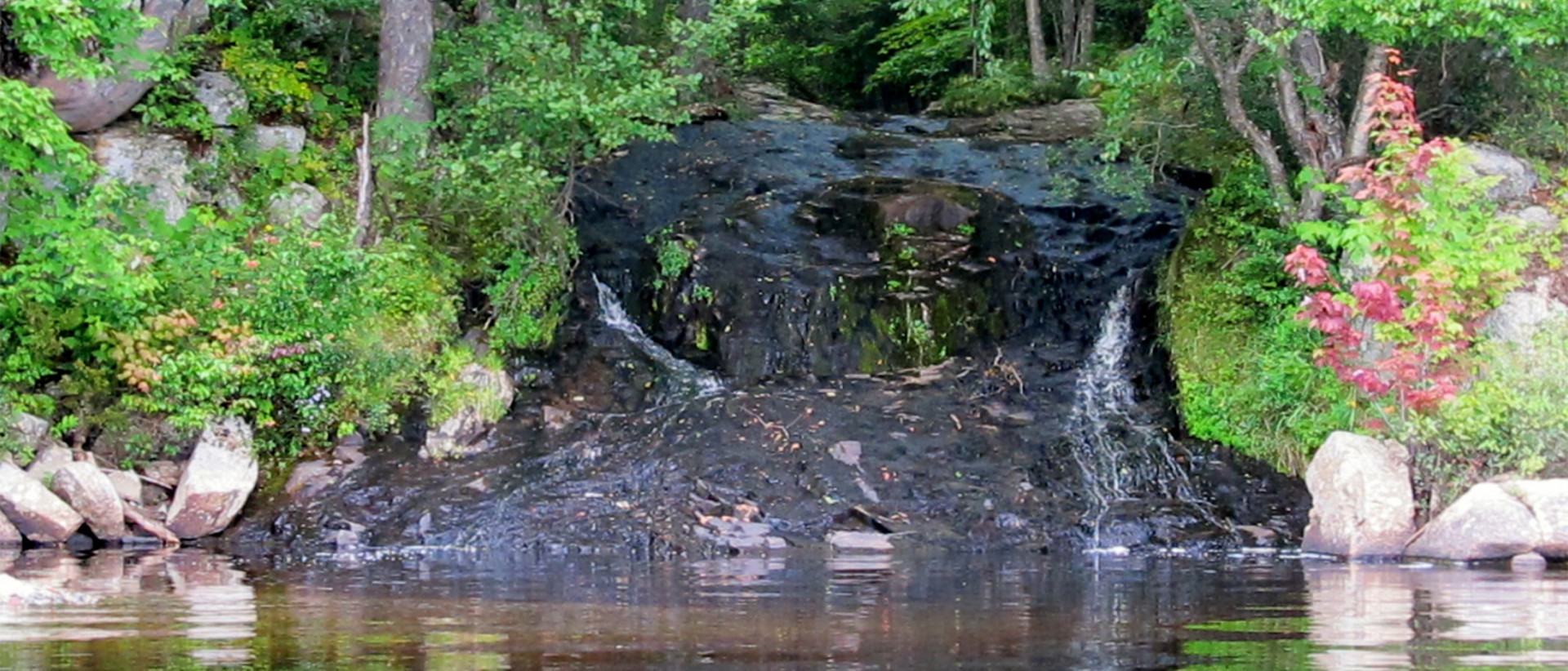
After the loon photo shoot, which took a considerable amount of my time, I headed to Grindstone Bay. Grindstone Bay was absolutely beautiful, peaceful, with shallow clear water and a small water fall. I paddled and floated around and took more shots.
At 6:15 p.m. I returned to the launch site. Don’t let that scare you! This was not a long trip - it only took me an hour to return, which included paddling into some of the coves again and taking more shots. It’s always difficult for me to take out, I always feel like I am leaving a little piece of paradise, even when I am hungry!
Luckily, there are plenty of places to pick up a good bite to eat after an awesome day paddling around Tupper Lake. Ready to hit the water? I am!