


44.110212, -74.670792
Hitchins Pond and Upper Dam
Location:
Route 421, Tupper Lake
Additional Info:
View Brochure
Website:
Email:
Phone:
(518) 359-3328
The road has gentle hills and quickly delivers you to Lows Upper Dam at Hitchins Pond, which is a very scenic and historic location.
At the dam, you can take an optional 1.5 mile round trip hike up Low's Ridge where there are spectacular views of the Bog River Valley and High Peaks.
Hiking
This is a popular destination in the summer, with access to other trails with scenic overlooks, and a spur trail for easy shoreside access.
Trailhead
From Tupper Lake, head southwest on Park St toward High St for 0.2 miles. Turn left onto NY-30 S/Wawbeek Ave, and continue for 8.7 miles. Take a left on CR 421 heading west.
Hiking Access
Follow the road (CR 421) for 7.5 miles, to a fork in the road, with a yellow gate across the left road. Park at this point. The road to Hitchins Pond/Upper Dam is the one on the left, past the gate. Walk in on the level, dirt road to the Upper Dam, take a left and head towards Hitchins Pond.
Cross the railroad tracks and come to the next gated road on the left — note there are no trail signs pointing toward Hitchins Pond. The access road is mostly flat and passes Hitchins Marsh on your left. The marsh is a massive expanse of land that would make anyone feel small.
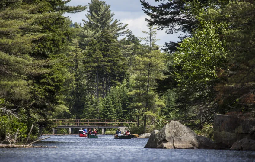
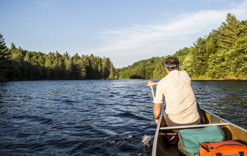
Paddling
You can also hike a short distance downriver to Hitchins Pond, where there is a nice open picnic area as well as access to the Pond.
Canoe Access
Follow the same road (CR 421) as the hiking trailhead, but for 5.8 miles, and make a left (follow signs) and follow another .7 mile to the lower dam on the Bog River. You can put your canoe in here, and paddle into Hitchins Pond.
Camping
There are 5 designated camping sites on Hitchins Pond. The Lows Ridge–Upper Dam Trail leads to a steep ridge with open rock ledges and wonderful views. To access Hitchins Pond by foot, hike along an old dirt road from State Route 421 for 2-1/2 miles to end up at the Low’s Lake Upper Dam. At the Dam, it is a short hike downriver to Hitchins Pond.
Birding
Hitchins Pond has plentiful loons, along with osprey, ravens, spruce grouse, and bald eagle. Paddlers may access the pond on the Bog River, from the Lower Dam south of Horseshoe Lake.
Snowshoeing and Cross-Country Skiing
In the winter it gets much less use due to closed access roads. In the winter, you will need to start a bit further away at the snowmobile trailhead. The road is very flat and used as a snowmobile trail so it will be hard packed and easy to kick and glide upon. Along the 2.3 miles on Horseshoe Lake Road there are nice views over Horseshoe Lake and some wetland areas.
Hitchins Pond is a few hundred feet to your left, slightly downhill past some building remnants. The Lows Ridge Trail is on the right but not skiable, if you carried in snowshoes with you, it is an excellent stroll to some amazing views.
Elevation change
400 feet
Round trip distance
9 miles
This route can take more than 8 hours for experienced skiers to complete. It is not recommended for beginners or families with kids.
Trailhead
From the intersection of Route 30 and Route 28 in Long Lake, follow Route 30 toward Tupper Lake. Turn left on Route 421, continue for a little over 5.25 miles to the end of the plowed road and park there.
Waterfront Sites, Wooded Sites


Websites
- https://www.dec.ny.gov/lands/75295.html
Packages and Promotions
range
Valid Apr. 4 - Apr. 8
Valid Mar. 24 - Apr. 8
Farm Fresh Buffet & Salad Bar Meal Reservations for Eclipse
ADK Food Hub
ADK Food Hub, ADK Food Hub
Full Buffet with hot offerings from the farm... pastured and organically fed pork and beef & Salad Bar chili, nachos, homemade breads, soup, etc... with a strong focus on delicious, fresh, local, organic and healthy
promotion
Eclipse ADK 2024, Special Events, Dining Deals