


44.159583, -74.677433
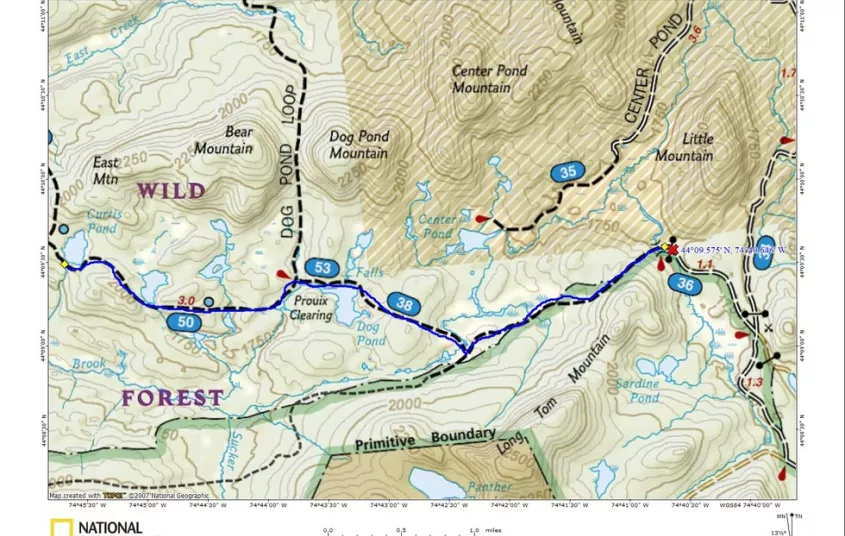
Sucker Brook Road to Curtis Pond
The Sucker Brook Road at the Grass River has been turned into a foot trail only and is often referred to as Otter Brook Trail.
Hiking
From the gate you immediately come to a crossing of the Grass River over a foot bridge over the span and from there you will climb up and over a shoulder of Long Tom Mountain. It remains flat for a bit before you start a long mellow descent to a crossing of an inlet of Center Pond. A short climb will bring you back up to a trail register on the Cranberry 50 Trail. Follow right toward Dog Pond and start a descent to a small wet area that has been slightly rerouted. Dog Pond comes in just over a mile from the past intersection, but there has been severe beaver activity in the area and you will need to go around it to the right. There is a lovely little waterfall on the right as well.
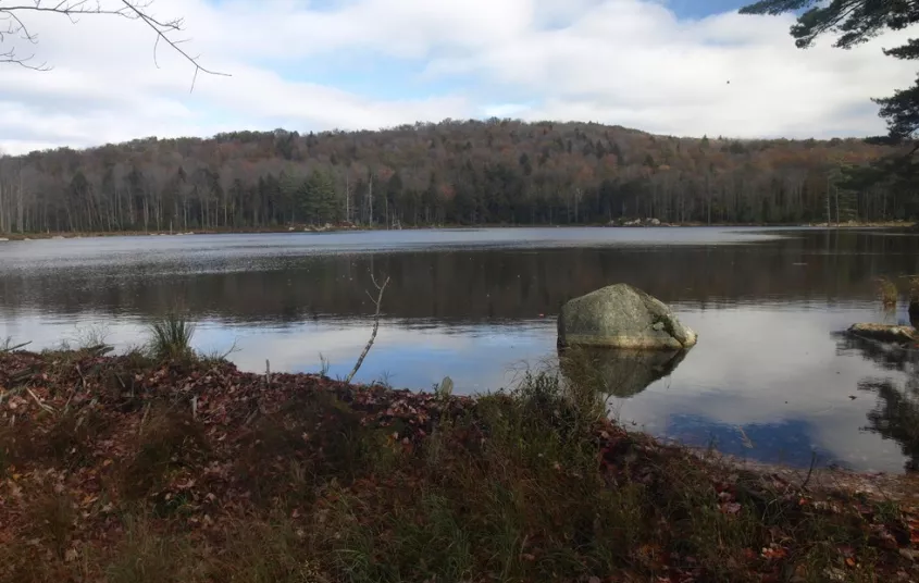
In 0.4 miles past Dog Pond you come to the Prouis Clearing intersection on the Dog Pond Loop, take a left toward Curtis and Irish Ponds. Irish Pond and what is called Willy’s Pond comes next up with about 0.7 miles in between each. Curtis Pond comes 0.5 miles further along and slightly uphill from the prior. A nice campsite on the pond is located on shore. Cranberry Lake is 1.2 miles away if you were to continue on this trail and eventually you would come out in Cranberry Lake.
Distance Round Trip: 12.0 Miles
Getting there
From the intersection of Route 3 and Route 30 in the Village of Tupper Lake follow Route 30 toward Long Lake. Continue to Route 421 (Horseshoe Lake Road) on the right and follow here to the very end. It’s around 6 miles back to the railroad tracks, but you will need to continue another nearly 4-miles to the end of the dirt road. The dirt road is a bit rough in areas making it a slow trip with a low clearance vehicle, but very doable.


Packages and Promotions
range
Valid Apr. 4 - Apr. 8
Valid Mar. 24 - Apr. 8
Farm Fresh Buffet & Salad Bar Meal Reservations for Eclipse
ADK Food Hub
ADK Food Hub, ADK Food Hub
Full Buffet with hot offerings from the farm... pastured and organically fed pork and beef & Salad Bar chili, nachos, homemade breads, soup, etc... with a strong focus on delicious, fresh, local, organic and healthy
promotion
Eclipse ADK 2024, Special Events, Dining Deals