


44.212446, -74.829217
Bear Mountain
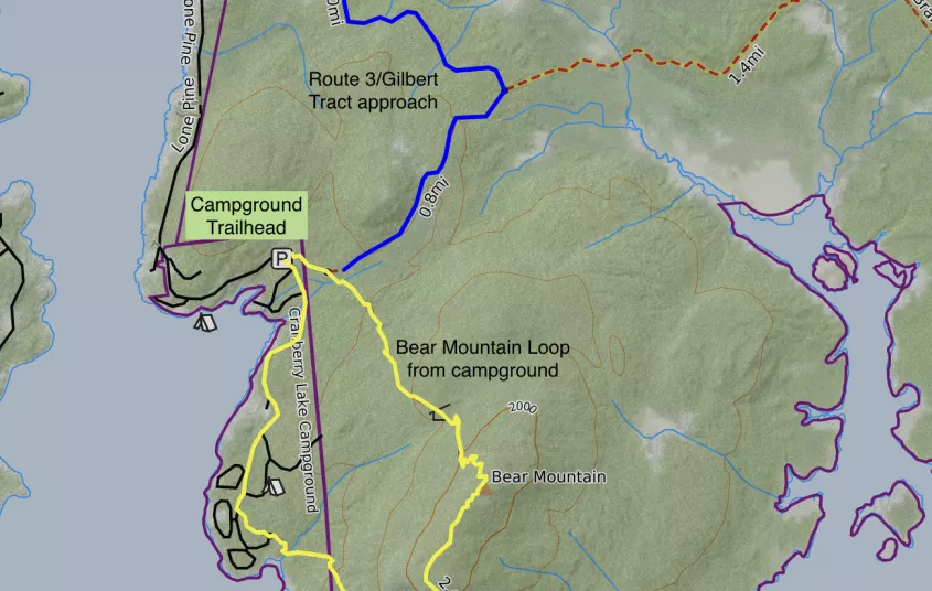
Bear Mountain is located in the Cranberry Lake State Campground, but can be accessed via Route 3 as well for a longer hike.
Getting there
From the intersection of Route 3 and Route 30 in the Village of Tupper Lake follow Route 3 toward Cranberry Lake. Follow Route 3 for 25 miles to Lone Pine Road in Cranberry Lake on the left. Follow Lone Pine Road to the end at the Cranberry Lake State Campground. There will be a day use fee involved for this approach.
Bear Mountain from Cranberry Lake Campground
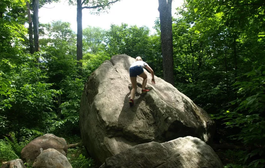
The trailhead is rather large and not easy to miss. The kiosk and trail register is right at the large, paved parking lot near campsite #28. Following the trail you will hike by a few campsites on the right a ways back in the woods and slowly start to gain elevation. The trail switchbacks through the forest, passing small rock ledges, and then comes to the top. The actual summit is slightly off the trail. If you wish you could turn back here, as the summit does not have any views, the views are past the summit and down the trail further.
To complete the loop, stay on the trail as it starts off quite flat and then slowly descends. The trail will continue to descend moderately to a rock viewing area where Cranberry Lake can be seen down below. This viewing area is quite a nice location, and the only viewing platform the trail will offer. The trail descends steeply in a few spots past the view before it comes to the low lands. A slight climb before a final descent will bring you back to the campground roads.
From here you will have to walk the campground roads back to your car, roughly 1 mile away, unless you have the option of a second car.
By the numbers
- 3.7 mile loop
- Summit elevation: 2175’
- Elevation Gain or Loss: 800’
Bear Mountain from Route 3
This is a longer alternate route to one of the larger mountains in the region. You'll start at the Gilbert Tract trailhead, where the recently built East Connector trail starts. The East Connector trail is a newer portion of the Cranberry Lake 50, and connects the Gilbert Tract trailhead with the Burntbridge Pond trail. Continue on the East Connector trail for 1 mile until you reach the Bear Mountain trail (campground connector trail) on your right. Follow this for another 0.8 miles until you turn left to head up Bear Mountain. At this point, the trail follows the description above. If you decide to do the loop, the round-trip distance will be 7.5 miles. If you don't complete the loop, and do an out-and-back to the true summit with the benchmark (doesn't go down to the view), then the trip distance would be 5.7 miles with 900' of elevation gain. The view is roughly 0.5 miles over the top of Bear Mountain.
- Getting to the Route 3 trailhead: From the intersection of Route 3 and Route 30 in the Village of Tupper Lake follow Route 3 toward Cranberry Lake. Just a quarter mile outside of Cranberry Lake is the trailhead for Gilbert Tract on the left, park here.
- Distance round trip from Route 3/Gilbert Tract: 7.5 miles
- Elevation gain from Route 3/Gilbert Tract: 1100’
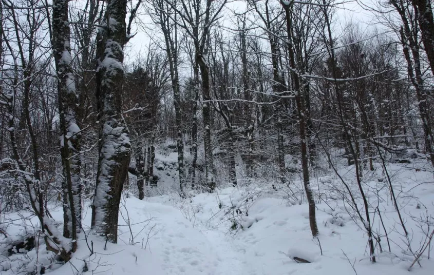
Winter
Bear Mountain is a fantastic snowshoe or cross-country ski option for the area. If you park at the Gilbert Tract trailhead, you can try your hand at the short and gentle Gilbert Tract Ski Loop, and then consider the longer trek to Bear Mountain from the same parking area.


Packages and Promotions
range
Valid Apr. 4 - Apr. 8
Valid Mar. 24 - Apr. 8
Farm Fresh Buffet & Salad Bar Meal Reservations for Eclipse
ADK Food Hub
ADK Food Hub, ADK Food Hub
Full Buffet with hot offerings from the farm... pastured and organically fed pork and beef & Salad Bar chili, nachos, homemade breads, soup, etc... with a strong focus on delicious, fresh, local, organic and healthy
promotion
Eclipse ADK 2024, Special Events, Dining Deals